The Course
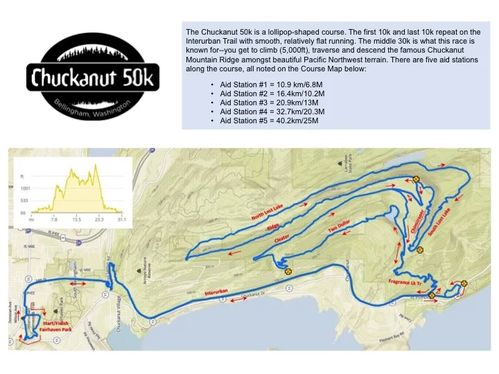
The Chuckanut 50k is a lollipop-shaped course. The first 10k and last 10k repeat on the Interurban Trail with smooth, relatively flat running. The middle 30k is what this race is known for--you get to climb (5,000ft), traverse and descend the famous Chuckanut Mountain Ridge amongst beautiful Pacific Northwest terrain. There are five aid stations along the course, all noted on the Course Map below:
Aid #1 - 6.8 miles, Lost Lake Parking Lot - 4.2 miles to next
Aid #2 - 10.2 miles, Two Dollar Trailhead on Cleator Rd - 6.2 miles to next
Aid #3 - 13 miles, top of Cleator Rd - 7.3 miles to next
Aid #4 - 20.3 miles, bottom of Chin scraper - 4.7 miles to next
Aid #5 - 25 miles, where Fragrance Lake Trail meets Interurban - 6.1 miles to finish
Click Here for a downloadable/printable version of the map.
Click image for a downloadable PDF
* The course map was created by Tad Davis.
** Here is a link to a GPX file also provided by Tad Davis.
** Google Map Link that details the Start and Finish Routes Out of and back in to Fairhaven Park.